Friday 25 September 2009

Beautiful Pakistan Pictures - Beautiful And Highest Mountains in the World

Nanga Parbat
Nanga Parbat
Nanga Parbat is the ninth highest mountain on Earth. Nanga Parbat means "Naked Mountain" in English, parbat deriving from the Sanskrit word parvata meaning "mountain, rock", and nanga from the Sanskrit word nagna meaning "naked, bare" Known as the "Killer Mountain," Nanga Parbat was one of the deadliest of the eight-thousanders for climbers in the first half of the twentieth century; since that time it has been less so, though still an extremely serious climb. It is also an immense, dramatic peak that rises far above its surrounding terrain[WikiPedia].
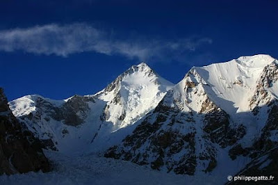
K-2
K2
K2 is the second-highest mountain on Earth (after Mount Everest). With a peak elevation of 8,611 metres (28,251 ft), K2 is part of the Karakoram range, and is located on the border between the Taxkorgan Tajik Autonomous County of Xinjiang, China and the Northern Areas of Pakistan. K2 is known as the Savage Mountain due to the difficulty of ascent and the 2nd highest fatality rate among the 'eight thousanders' for those who climb it. For every four people who have reached the summit, one has died trying. Unlike Annapurna, the mountain with highest fatality rate, K2 has never been climbed in winter[Wikipedia].

Gasherbrum - 1
Gasherbrum-1
Gasherbrum I (also known as Hidden Peak or K5) is the 11th highest peak on Earth, located on the Pakistan-China border. Gasherbrum I is part of the Gasherbrum massif, located in the Karakoram region of the Himalaya. Gasherbrum is often claimed to mean "Shining Wall", presumably a reference to the highly visible face of the neighboring peak Gasherbrum IV; but in fact it comes from "rgasha" (beautiful) + "brum" (mountain) in Balti, hence it actually means "beautiful mountain" [Wikipedia].

Gasherbrum - 2
Gasherbrum - 2


Gasherbrum - 2


Gasherbrum - 2
Gasherbrum II (also known as K4) is the 13th highest mountain on Earth, located on the border of Pakistan-China. Gasherbrum II is the third highest peak of the Gasherbrum massif, located in the Karakoram range of the Himalaya [Wikipedia].
Top 5 Links:
Broadpeak
Broadpeak
Broad Peak (originally named K3), known locally as Faichan Kangri, is the 12th highest mountain on Earth. The literal translation of "Broad Peak" to Phalchan Kangri is not accepted among the Baltis[Wikipedia].

Saturday 12 September 2009

Beautiful Pakistan Pictures - Amazing Makran Coastal Highway

Makran Coastal Highway is a 653 km-long coastal highway along Pakistan�s Arabian Sea coastline. It runs primarily through Balochistan province between Karachi and Gwadar, passing near the port towns of Ormara and Pasni.
travel image
Makran Image
Makran Coastal Highway Image
Prior to the construction of the Makran Coastal Highway in 2004, the port city of Karachi was linked to the port town of Gwadar via an uncarpeted �jeep� or �dirt� track. The journey between Karachi and Gwadar used to take at least two days and took a heavy toll on the �wear and tear� of vehicles. It was considered preferable to take the safer but longer route via Quetta.
Beautiful Highway Image
Amazing Highway Image
To Karachi Image
Amazing Pakistan Image
Pasni Photo Image
Amazing Pics Image
After completion of the Makran Coastal Highway, the average journey time between Karachi and Gwadar has been reduced to only 6 to 7 hours and transportation costs have also been reduced.
Road Image
Highway Image
Highway Image 2
Highway Image 3
Surroundings Image
Tourist Place Image
Tourist Image
Beautiful Place Image
On the way Image
Beautiful Road Image
Makran Image 3
Sea View Image
Sea View Image 2
Pasni Image 3
The Makran Coastal Highway was conceived and built by the Government of Pakistan with the following objectives:
Firstly,To develop infrastructure and boost economic activity in the areas along Pakistan�s coastline.
Secondly,To improve the transportation and communications infrastructure in Balochistan province.
Thirdly,To develop the coastal towns of Ormara, Pasni and Gwadar into major port cities.
Fourthly,To link Ormara, Pasni and Gwadar with the rest of Pakistan�s national highways network .
Lastly,To develop the seafood industry along Pakistan�s coastline by reducing the time and costs involved in transporting fresh seafood from seafood catchment areas to major cities in Pakistan as well as export processing zones in Karachi and Gwadar.
Makran Image 4
Beautiful Makran Image 5
Beautiful Makran Image 6
Beautiful Makran Image 7
By looking into the photographs, you can easily judge that its really amazing to travel through that area. Its has a lot of attraction for tourist around the world. From Karachi to Gawadar, Makran Coastal Highway is truly a symbol of pride for all Pakistani's.

Wednesday 26 August 2009

Beautiful Pakistan Pictures - 7 Most Amazing Valleys of the World

Naran Valley
Naran Valley is located in North-West Frontier Province, Pakistan. Naran is the main tourist center in Kaghan Valley. It is the best base for treks and walking in the valley. 


Palas Valley, Kohistan
Palas valley in Kohistan District, NWFP, Pakistan. The Palas Valley is located on the left bank of the river Indus. Palas Valley in Kohistan Truly one of the most beautiful valley in Pakistan.


Swat Valley
Swat is an administrative district in the North-West Frontier Province (NWFP) of Pakistan located 160 km/100 miles from Islamabad, the capital of Pakistan. It is the upper valley of the Swat River, which rises in the Hindu Kush range.With high mountains, green meadows, and clear lakes, it is a place of great natural beauty that used to be popular with tourists as "the Switzerland of Pakistan"


Soon Valley
Soon Valley is situated in the north west of Khushab. Soon Valley starts from Padhrar village and end to Sakesar that is the highest peak of Salt Range. The length of Soon Valley is 35 miles and average width is 9 miles. Although not as cold as the valleys up north, Soon valley consists of beautiful lakes, waterfalls, jungles, natural pools and ponds.


Rama Valley
Rama Valley is thickly forested with huge pine, cedar, fir and juniper trees. The valley is about 3300 meters (10800 feet) above sea level and thus is snow covered for 7-8 months of the year. In summer, it becomes lush green; conditions favored by local shepherds.
From here one can trek to east side of the Nanga Parbat (also known as the Killer Mountain), the world's 8th highest mountain.


Hunza Valley
Hunza, a remote mountain kingdom, may have been the inspiration behind James Hilton's "Shangri-La." The area opened up in the 1970s following the completion of the Karakoram Highway (KKH); an engineering marvel tracing the old silk route from Pakistan into China.

The beauty of this mountain paradise is matchless; from the soft blossoms of the apricot trees to the dark snowcapped rock monuments of Rakaposhi (7788 m.) and recently climbed Ultar (7388 m.) jabbing a vivid blue backdrop high above.


Chitraal Valley
Chitral is undoubtedly the most romantic, captivating and enchanting place in the majestic Hindukush range. It is a mountainous area in the extreme north of Pakistan. The landscape of Chitral is extremely mysterious, with its steep harsh mountains, lush green valleys, beautiful meadows and big glaciers, which have made it one of the most difficult and inaccessible area of the world.